|
|
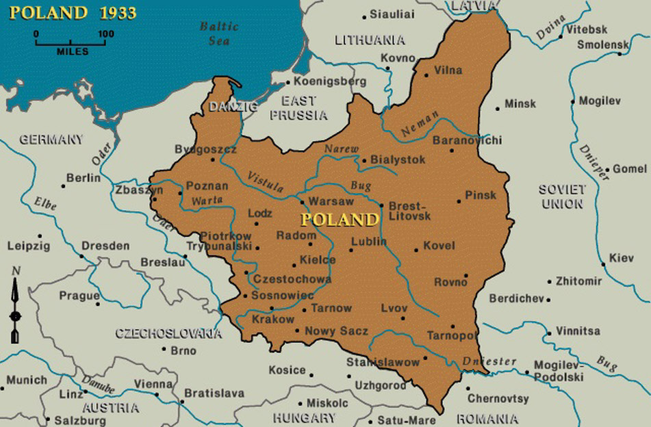
This map shows Poland in 1939, generally with the borders granted to it in the Peace of Versailles, although the details of the eastern border were decided by the treaty that ended the Polish-Soviet War of 1918-19. Modern Poland occupies a rather different area, after losing a great deal of land in the east to the Soviet Union in 1945 but gaining large areas from Germany in the west and north.
US Holocaust Memorial Museum